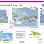
Maps of the 2010 Haiti earthquake, including a map of the tectonic setting and one of the epicentral region. Prepared by the United States Geological Survey in cooperation with the Global Seismographic Network.

American Journalist
Maps of the 2010 Haiti earthquake, including a map of the tectonic setting and one of the epicentral region. Prepared by the United States Geological Survey in cooperation with the Global Seismographic Network.
